Group Size: From 2 to 16 participants
Tour cost: Contact Us
Day 1: Vientiane – Arrival
Pick at the airport and transfer to city for check in .If time permit we will visit some main city tour destination .
Accommodation: Sengtawan hotel or similar
Day 2: Vientiane – Paksan
Pick at your hotel in Vientiane capital, after immigration formalities meet Lao guide or pick up at your hotel and we drive to the town visit That Luang stupa, the oldest and largest stupa in Laos and the other sites by preference before driving to our destination of Paksan where we stay overnight .
Vientiane has been the capital of Laos since 1560, when the country was divided into three kingdoms, then lost its independence after the Siamese (Thai) invasion in late 18th century. Vientiane remained empty until the end of the 19th century. It began to be resettled again little by little.
The provincial capital of Bolikhamsai is Paksan, locates in the middle part of the country a blip of a town that sits at the confluence of the Nam San and Mekong rivers almost opposite the small Thai town of Bueng Kan, visible across the river. The provincial capital is a sleepy transportation hub, mostly just used as a place to stay before heading along the back road to Phonsavan or across the border into Thailand.
Distance: 160 km (approximately 3 hours driving)
Meal: B , L , D
Accommodation: Sounantha hotel
Day 3 : Paksan – Thasi
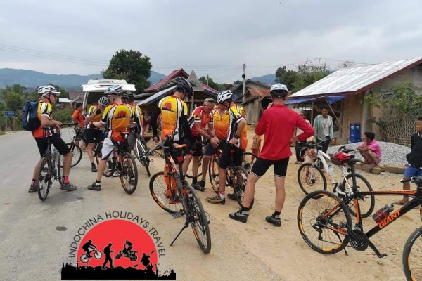
After breakfast we start riding from our hotel, we turn left from main road No. 13 south head east in the direction to Vietnam along the main road in remote area, on the way we’ll pass a small town of Muang Bolikhan and villages almost they are Lao low landers. Picnic lunch will be brought from restaurant in Paksan and we will find the good place when we are hungry. We stay overnight at Thasi village, dinner at local restaurant
Attitude: m above sea level
Distance: 80 km
Meal: B, L, D
Accommodation: Guesthouse
Day 4 : Thasi – Muangkhoun
Our guide will prepare breakfast for the group, after breakfast, we continue our journey to our destination of Muangkhoun, the road at the first section is gentle and surrounded by beautiful scenery, we pass the paddy fields and dry rice field (slash and burn cultivation) and villages at remote area some are Kmu (up lander people). We find lunch stop by the road when we are hungry. The last section of 30 km is hilly, we start climbing up to 1200 m on top of the highest point for today, optional drive to the top or transfer to last section to our destination depending on the time. Overnight at the guesthouse in Muang Khoun, Muang Khoun the old capital of Xiengkhouang which was heavily damaged during the Indochina war all houses and temples were bombed and burned in 1963 - 1973.
Attitude: 300 m – 1200 m above sea level
Distance: 110 km
Meal: B, L, D
Accommodation: Guesthouse
Day 5 : Muangkhoun – Phonsavan
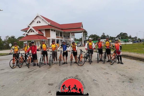
Today is short day, after breakfast we continue riding to the capital district of Xiangkhuang province (Phonsavan). On the way we turn from the main road to visit the plain of jars form site 2 and site 1. We stop for lunch at the local restaurant before cycle to the town and after check in hotel free to explore the small town on your own, we recommend visit the UXO center (unexploded ordnance), we stay overnight at the hotel in town. ,The history of the stone jars (ancient stone jars) remain a mystery today, there are more than 60 sites, scattered in different group all across the plateau. Only three groups have been surveyed and assigned registration. The other groups have not yet been surveyed because the locations are covered with thick bushes and contaminated by many remaining UXOs (Unexploded ordinances) leftover from the Indo-China war. The highest jar is more than 3 meters. There are several difference theories as to the purpose of the jars, which are estimated to be 2500 – 3000 years old. According to local legend, King Khoun Chuang had them constructed in order to store wine for the big celebration of his victory in the 6th century. Phonsavanh used to be the battled field between Lao communist government and royal government in 1964 – 1973.
Attitude: 1060 m – 1100 m above sea level
Distance: 40 km
Meal: B, L, D
Accommodation: Favanmai hotel
Day 6 : Phonsavan – Muangkham
Today is short day so we don’t have to start early; we turn right on direction to Vietnam border, on the way we stop at Hmong villages (high lander) and stop for photo of rice fields, riding today is not very hard, the road is up and down hills, we reach our destination a small town of Muangkham in the afternoon, optional cycle to visit the cave, local people hid during Indochina war, it was shot by the rocket from the royal Lao air force, more than 300 villagers were killed in the cave because of Napalm bomb. Overnight at the guesthouse and dinner at the local restaurant.
Attitude: 1100 m – 650 m above sea level
Distance: 51 km
Meal: B, L, D
Accommodation: Guesthouse
Day 7 : Muangkham – Namneuan
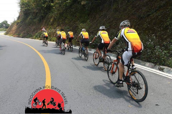
After breakfast at the local restaurant, we head north at the junction to Vietnam border, the road today is quiet, after 5 km undulating road from our guesthouse we start the big climb of 15 km at 1500 m above sea level on the top, after water stop we cycle downhill and the next climb is shorter. Picnic lunch will be brought by our guide and we stop for lunch on the way when we fell hungry. The last section of 20 km we cycle downhill from the attitude of 1400 m – 500 m above sea level to Namneuan village where we stay overnight.
Attitude: 600 m – 1500 m above sea level
Distance: 86 km
Meal: B, L, D
Accommodation: Guesthouse
Day 8: Namneuan – Viengthong
Breakfast today is prepared by our guide at the local restaurant, today is short day but big climb, after breakfast we leave Namnuean and start the first big climb of 7 km from 600 – 1000 m to the junction to Vietnam border and we turn left to Viengthong, we cycle through the hill tribe villages on the quiet road, we stop at the villages to see the local life style and see they work in the rice fields, it is very strange for local to see Fa Lang (foreigner) ride the bicycle on the long distance. After the top we cycle long downhill to the bottom, from the bottom we continue riding up and down hill before the top and the last 18 km from the top we cycle downhill to the to the Viengthong where we stay overnight. After arrival in Viengthong, freshen up before walking to nearby hot springs to douse worn legs before exploring the small town set on the Nam Khan River and largely inhabited by a collection of hill tribes particularly Hmong and "lowland" Lao. Dinner at the local restaurant and overnight at guesthouse.
Attitude: 600 m – 1550 m above sea level
Distance: 66 km
Meal: B, L, D
Accommodation: Guesthouse
Day 9 : Viengthong – Nongkiaw
Today is long day over the "Laotian Alps," rising early from the noise at sunrise from the hill tribe market directly in front of our hotel. After browsing the market, we'll begin biking after breakfast. Today we ride National route No 1c between Viengthong and Viengkham passing through the beautiful jungle and forest scenery of two National Parks with lush green mountains over three passes. After departing Viengthong, cycling on flats until reaching our first challenge, a 500 m climb, before descending to a winding river valley road for about 10 km to the bottom, from the bottom the road is gentle, we stop for lunch under the tree by the road, the last climb is about 15 km to the top before descending to Viengthong where we stop riding and transfer the rest to our destination of Nongkiaw. Muang Ngoi (Nongkiaw) was controlled by the communist before 1975 and the province was under control of Pathet Lao. During Vietnam War, people in this area hid in the caves in the day times and worked at night because of continuous bombing (land mines remain in the area).
Attitude: 700 m – 1300 m above sea level
Distance: 168 km
Meal: B, L, D
Accommodation: Phaxang bungalows
Day 10: Nongkiaw – LuangPrabang
Today we'll ride the initial, quiet and scenic section out of Luang Prabang which after 30 km, joins a larger road with traffic coming in from China, mostly flat with short rollers. After 80 km riding on undulating road or drive some section to Mekong River, we have lunch at the local restaurant at the confluence of Nam Ou River, after lunch we cross the Mekong River to the other side to visit the renowned Pak Ou caves. Located beside the river, the cave is filled with Buddha images and is a sacred place of worship for locals. , After the caves, optional riding or drive the rest 30 km to LuangPrabang. In the late afternoon we arrive Luang Prabang
Attitude: 400 m – 300 m above sea level
Distance: 140 km
Meal: B, L, D
Accommodation: villa Chitladda or simila
Day 11 : LuangPrabang day free
Today is your free day to explore the world heritage town. We recommend to get up at 6:00 AM to view traditional alms procession of monks passing slowly through town, and afterwards visit local market before get back to your hotel for breakfast before visit other sites in town such as former royal temple of Vat Xiangthong and former royal palace (museum) Late afternoon climb up Phousi mount to see panoramic view of town and sunset. Or you can do elephant riding outside town, visit waterfall and other activities , Luangprabang is the oldest city in Laos, and before the 16th century it was the capital city of the land of million elephants (Laos). The town is a beautifully preserved and in 1995 it was added to UNESCO`s World heritage list.
Meal: B
Accommodation: Villa Chitlatda or similar
Day 12 : LuangPrabang – Kasi
We drive out of town along route 13 heading south to Phoukhoun town and cycle to the restaurant with the best panoramic view on top of mountain. After having lunch we will continue down route 13 ,this 25 km descent is one of the best in Southeast Asia, we will enjoy a most excellent after noon ride. We then have a short climb before a flat ride into Kasi where we stay over nigh.
Elevation: Phoukhoun = 1340 m. Kasi = 405 m
Distance: transfer 130 km, ride 50 km
Meal: B, L, D
Accommodation: Somchit guesthouse
Day 13 : Kasi – Vangvieng
We should be able to do today’s ride in a single morning leaving extra relaxation time in Vanvieng. We continue along route 13 and although there are some short climbs most of the ride is downhill or flat. The scenery is just beautiful and you should really enjoy stretching your legs. We will stop for refreshments a few times along the way, but we make a main stop after 50 km at a big village of Ban Phatang. The last 18 km is a fast flat ride among the spectacular limestone mountains. We will reach the hotel in time to enjoy lunch overlooking the river. The afternoon is free to explore the town or take a swim in the river. Vangvieng has a lively traveler’s scene with all the usual accompanying facilities: e-mail, pubs, pizza and many young foreigners.
Elevation: Kasi = 405 m. Vangvieng = 280 m
Distance: 55 km
Meal: B
Accommodation: Vansana hotel or similar
Day 14 : Vangvieng – Vientiane
\After breakfast we continue riding along the route 13 and stop for refreshment every 20 or 25 km. The rest of the morning is along undulating roads to Hinherb village. After 69 km we reach a long bridge, we stop for lunch in a restaurant. The afternoon ride is along fast flat roads. After 83 km before we get into a small town of Phonhon we stop cycling and load our bike in the van and drive the rest to our destination Vientiane capital where we stay overnight.
Altitude: Vangvieng = 280 m. Phonhon = 190 m
Ride: 83 km, transfer = 70 km
Meal: B / L
Accommodation: Sengtawan hotel or similar
Day 15 : Vientiane flight to Pakse and cycle to Champasak.
Fly to Pakse in southern Laos, meet the local guide and support van with bikes, we cycle to Champasak through the town of Pakse, We pass many small villages and paddy fields before we arrive at the Pre-Angkor ruins of Wat Phou, which once used to be the worship place of Hindu worshipers then were replaced by Buddhist temple in the late 11 century. We spend some time here exploring the temple before riding the last 10 km to our hotel in the small town of Champasak on the right side of the Mekong River.
Elevation: Departure point: 120 m above sea level. Arrival point: 124 m above sea level.
Distance: 47 km
Meal: B /L / D
Accommodation: Siamphone hotel
Day 16 : Champasack – Khong Island (4000 islands)
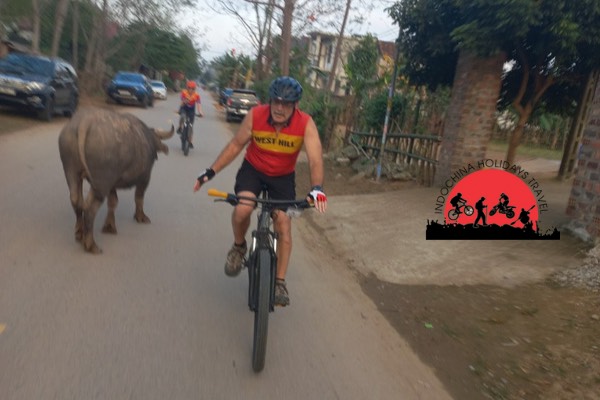
Si Phan Done in Lao means 4000 islands; it is the widest and most charismatic part of the Mekong River and is our destination today. We leave as early as we can after breakfast, after 2 km of riding from the hotel, we cross the Mekong River on a very unusual mode of transport to the other side and after a short ride to the main road and then start heading south again towards Cambodia. Today is mainly flat with quiet road and some interesting scenery, we pass many villages with children standing in groups waving their hands and saying hello, it would be strange for them to see the tourists travel by bicycles (it feels hard for them).so we stop every 20 or 25 km for refreshments and we have lunch under the tree by the road when we feel like it. We then cross back over to the Mekong River to one of the biggest islands in the Mekong River, Kong Island (it is the hometown of the former Lao president). We cycle a short way to our hotel. Dinner is in the hotel.
Elevation: Departure point: 124 m above sea level. Arrival point: 120 m above sea level.
Distance: 113 km (on good quality asphalt road, and mainly flat)
Meal: B / L /D
Accommodation: Villa Muangkhong.
Day 17 : Khong Island – Khone Island (400 Islands)
Today is a day to explore, we once again cross the river and head south where we ride as far as the Khon Pha Pheng waterfall, we rest for a while before riding back and taking a short boat trip to the small island of Don Det where we will have lunch. After lunch we ride along the old French Railway down to the beach where we get on small boats to Cambodian waters in search of freshwater Dolphins, After an hour we ride back to the hotel at Don Khone island.
Distance: 55 km (Haft riding is on good quality asphalt road and the rest is on the path but it is a fantastic ride and flat)
Meal: B / L / D
Accommodation: Khounparn bungalows
Day 18 : Khone Island – Tad Fane waterfall (Bolaven Plateau)
An easy start to the day as we transfer back on the way we come for almost 2 hours to begin our journey into the coffee growing area of Laos, the Bolaven plateau. We head north to Pakse before starting to climb up into the temperate coffee-growing area renowned for its Arabica and Robusta beans. These beans fetch some of the highest coffee prices in the world. The road undulates but has a definite upward feeling. As we climb, we see coffee everywhere as the plantations converge on the side of the road. We finish at the wonderful Tad Fane resort, which provides a stunning backdrop and the very impressive Tad Fane fall, if you are feeling energetic you can cycle to the other waterfall for swimming. Alternatively, you can relax in the restaurant and take the wonderful view. Dinner is at the resort. (At a junction where we start riding is at an altitude of 150 m above sea level and the resort where we stay overnight is at an altitude of 960 m above sea level)
Elevation: Departure point 175 m above sea level.
Arrival point 959 m above sea level.
Distance: 30 km (on good quality asphalt road but ascend)
Meal: B / L / D
Accommodation: Tad Fane resort.
Day 19 : Tad Fane – Tad lo (Tad means waterfall)
(Resort is at an altitude of 960 m above sea level)Today is the best riding on this trip, after 12 km of the climb we reach the top of Bolavene plateau (at an altitude of 1280 m above sea level). However, riding in the early morning makes you warm through the cold morning on the plateau, and you still have more energy in the morning, after a short break in a small town on top of the plateau we continue our riding for another 38 km to a small town of Tha Teng (at an altitude of 860 m above sea level), this 38- kilometer descent is one of the best rides in this trip, we have noodle soup for lunch at the local restaurant, 30 km from our destination, Tad Lor Resort (at an altitude of 750 m above sea level) Riding after lunch takes us very easy downhill but on a dirt road for 21 km to the junction, the rest of the road just 9 km on asphalt road and it is mainly flat. We check in the hotel in the afternoon and it is your time for swimming at the waterfall, relax, enjoying the view, or ride around. Dinner is at the hotel.
Elevation: Departure point 959 m above sea level.
Highest point: 1280 m above sea level.
Arrival point: 346 m above sea level.
Distance: 80 km (12 km ascend, 68 km descend, and flat, including 21 km on a dirt road)
Meal: B / L / D
Accommodation: Sayse resort
Day 20 : Tad Lor – Pakse province
After breakfast, we head towards Pakse. This road undulates and has a couple of lengthy climbs in it one of 5 km and one of 49 km, but they are quite gradual before we turn right and head downhill into Pakse. The last 20 km into Pakse is downhill and can be covered quickly, be careful as we head into town as the traffic increases significantly.
Elevation: Departure point: 346 m above sea level.
Highest point: 606 m above sea level.
Arrival point: 170 m above sea level.
Distance: 85 km on good quality asphalt road
Meal: B / L
Accommodation: Sengaloun hotel
Day 21 : Pakse departure
After breakfast, transfer to the airport or land border for your departure.
End of service
Please consider the environment before printing
Group Departure date: Join in group departure on 16th Monthly
Private Departure : Based on your inquiry
Group Size: From 2 to 16 participants
Tour cost: Contact Us
Tour Cost Includes:
Tour Cost Excludes: